

See Beneath the Surface. Understand Your Lake Like Never Before.

Our lake mapping service reveals the hidden details beneath the water’s surface, from fish habitats and vegetation zones to sediment buildup and lake bed contours. With this deeper understanding, our ClearWater team can design a tailored plan to enhance the health and longevity of your aquatic environment.
How It Works
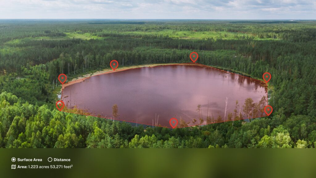
- Precision Scanning: We use advanced sonar and GPS technology to survey your pond or lake with pinpoint accuracy.
- Smart Data Processing: Our cloud-based system processes collected data through a proprietary mapping algorithm, generating a detailed visual model of your lake’s features.
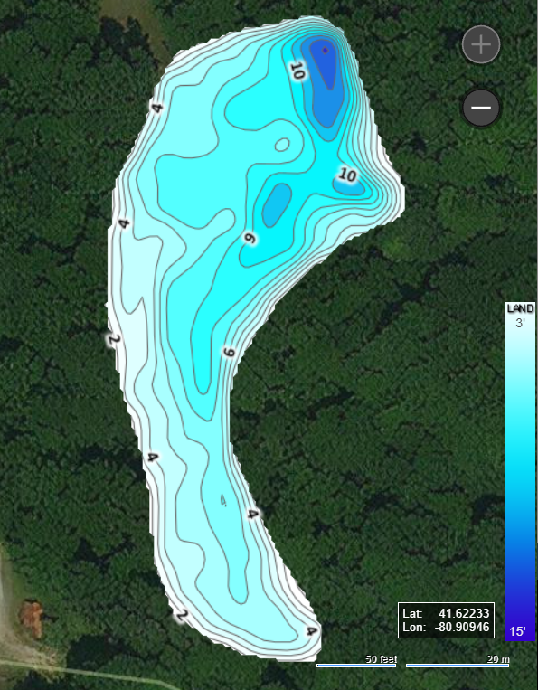
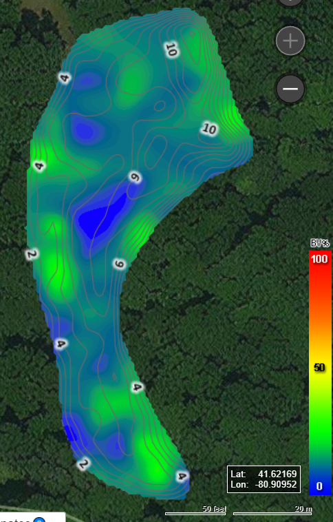
- Insightful Analysis: From water depth and plant density to bottom hardness, our team analyzes every layer of your waterbody to identify patterns and potential issues.
- Targeted Solutions: Based on your map results, our team can recommend the most effective management or treatment options to improve overall ecosystem balance.
Powered by Cutting-Edge Mapping Technology
Using EcoSound® lake-mapping tools, we collect high-resolution bathymetric (depth) data, vegetation density readings, and sediment composition. All surveys are conducted on-site by Clear Water technicians via specialized boats equipped with sonar and GPS instrumentation. Our system uploads and processes the collected data in the cloud, then quickly delivers custom, easy-to-read charts after the survey.
A Clear Water aquatic biologist personally reviews your results, explaining unique characteristics of your lake and recommending targeted improvements. From fishery health to muck reduction and aquatic vegetation control, our experts provide customized guidance to enhance your waterbody’s overall health.
Monitor Your Lake’s Evolution
All collected data is securely stored within ClearWater’s private system, giving you long-term visibility into your lake’s condition. Because we process each dataset consistently, our biologists can quickly compare past and current results. This allows them to track progress, identify emerging trends, and support ongoing waterbody management over time.
Contact us today to schedule your lake mapping survey to achieve the most out of your waterbody.


Follow Us!
Free Estimates! Call Today: 713-725-8628
Contact us: email us
Water Remediation USA, LLC
24616 Kingsland Blvd
Katy, TX 77494